 |
|
GANDER Data distribution
The technology to take up to 1 million wave height measurements every day will be based on that used by SOS since 1985. A radar altimeter on each satellite will measure the spread of the return radar pulse reflected from the sea surface. From this it is possible to calculate wave heights with an accuracy of 50 cm. The wind speed at sea level can also be determined from the roughening effect the wind has on the water surface, with a consequent loss of energy returned to the satellite as the wind increases.
The data will be downloaded to eight automated ground stations based at existing facilities in Europe, America, South America and India.
The data will then be validated, using the world-leading expertise built up by SOS. After this processing, GANDER data will be delivered to ships at sea via existing INMARSAT or other satellite communications networks. It will also be available by email. The processed information will be received by ships within 100 minutes of initial acquisition.
Services will be provided:
- in the form of a map every six hours, showing colour-coded wave heights and wind speeds, or
- with GANDER data overlaid on the most recent meteorological forecast, highlighting differences between forecast and actual storm intensity and track, or
- with the addition of projections of the movement of severe storms and wave fields based on trends in the GANDER data combined with computer wave models.
The information will be available within 100 km of
any point on the sea surface, and will be updated four times a day.
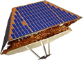
A mock ship display for GANDER is shown here.